Katabatic Winds: Cold Air, Slopes and Local Terrain
Understand a downslope process without assuming every Antarctic wind has the same cause.
Gravity gives the term its meaning
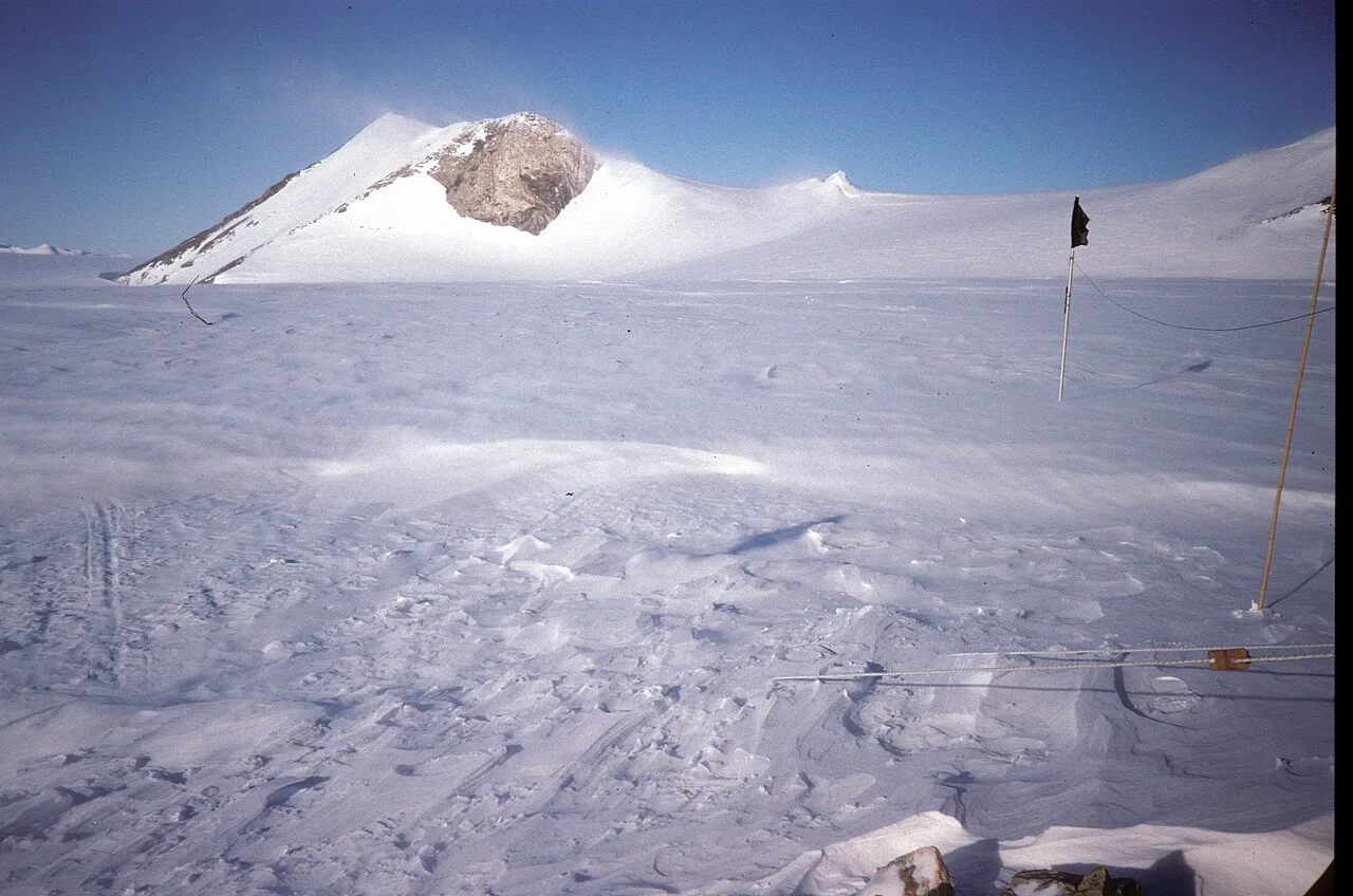
Katabatic flow is associated with relatively cold, dense air moving downslope under gravity. Antarctica offers large elevated ice surfaces where cooling and terrain can help organize such movement toward lower ground. The process explains an important kind of wind; it is not a statement that wind blows downhill at every place and moment.
Mawson's official climate description emphasizes the role of katabatic winds in its coastal setting. A station example is useful precisely because it locates the process in a particular landscape rather than treating the entire continent as one weather station.
Terrain changes what reaches a site
A broad slope can feed air toward a coast, while valleys and gaps can channel it. The wind observed at a building or runway also reflects local terrain and the wider pressure pattern. A map showing high inland ice is therefore not a direct forecast of surface gusts at a specific camp.
This helps explain why a label such as katabatic does not determine one speed. A physical mechanism and a measured wind record are different pieces of an explanation.
Distinguish a mechanism from an operational decision
For a science account, ask what supports the proposed cause: cooling, slope, wind direction and the regional weather pattern. For a travel or work decision, use current local observations, forecasts and the responsible program's procedures.
A clear sky is not evidence that wind-related hazards are absent. Conversely, identifying downslope flow does not authorize a reader to predict when conditions will become acceptable. This page supplies vocabulary for understanding a forecast discussion, not a threshold for safe outdoor activity.
A cross-section explains more than a continent-wide arrow
Draw elevated ice descending toward a coast and mark relatively cold air near the surface. The sketch helps show why gravity and terrain belong in an explanation of downslope flow. It should not imply that an entire atmospheric column slides downhill as a solid block. Nor should its arrow be read as a measurement of speed or the exact wind direction at every point along the slope.
Now add a valley and a ridge. Air reaching a particular observation site can be shaped by those features as well as the broader setting. The same regional process can therefore appear differently at different locations. A station description is valuable because it attaches the explanation to real terrain, but applying its numbers elsewhere requires evidence rather than copying a familiar Antarctic wind statistic.
A wind observation needs height, interval and location
Wind speed can be summarized over an interval, while a gust describes a shorter-lived feature according to the observing system's definition. Those quantities should not be compared as if they were identical. An instrument's exposure and position also matter. Before repeating a value, identify whether it is a mean, a gust, a maximum within a record or another defined statistic.
Imagine two fictional charts, one showing hourly averages and another showing brief peaks. The second can look more extreme even if both describe the same day. This is not a reason to ignore either chart; it is a reason to retain their definitions. A useful explanation connects the measured quantity to the question rather than selecting whichever value makes the strongest impression.
Cold air does not mean every strong wind is katabatic
A temperature reading and a strong wind observed together do not independently diagnose the cause. A scientific account considers the slope, direction, cooling and wider atmospheric situation. The katabatic mechanism can be important while other influences also shape the observed conditions. Describing those influences is more informative than assigning a single label to every windy Antarctic scene.
For a reader, ask whether the source explains why the term applies at the named location. An image of blowing snow may document visibility conditions but not identify the complete pressure and temperature structure. Keep the image's visible evidence separate from the meteorological explanation. They can support the same story without being interchangeable measurements of the same process.
Clear skies and visibility answer different questions
The absence of cloud overhead does not establish calm air at the surface. Likewise, visibility can be affected by material moving near the ground even when the sky above appears clear. An ordinary photograph captures one direction and moment, so it cannot establish the full conditions around a station or along a route. Read its caption for time, place and observation context.
This is useful vocabulary for understanding a local forecast, not a procedure for deciding to travel. Operational decisions depend on current observations, forecasts, terrain, personnel and the responsible program's rules. A general explainer cannot convert the mechanism into a universal acceptable wind threshold. Its contribution is helping readers understand why the forecast may discuss several variables instead of only air temperature.
Compare a station climate with today's conditions
A climate description summarizes a place over a defined period. A forecast concerns an upcoming interval, and an observation describes a measured condition. Mawson's account provides context for the station's environment, but its typical conditions are not a statement about the exact wind at another camp today. The distinctions remain important even when all three sources discuss the same general mechanism.
When reading a report, write down the site's terrain, the statistic used and the period covered. Then ask whether the author is explaining a recurring pattern or diagnosing a specific event. A strong explanation makes that choice explicit. Katabatic winds become understandable as a physical process interacting with local geography and weather, rather than a continental superlative used to explain every gust.
Read Mawson's climate description with a terrain sketch
The Australian Antarctic Program's Mawson climate account connects the station's winds with its setting and katabatic flow. Sketch the elevated interior and descent toward the coast, then locate the station. This makes the mechanism understandable without converting a station description into a continent-wide speed. The named place is part of the explanation.
Next distinguish a climate summary from a current observation. A typical direction or historical statistic describes a record; it does not forecast a gust at another camp. For comparing two reports, retain the station, averaging interval and whether the quantity is a mean or a gust. That small set of labels can explain an apparent numerical contradiction before any unusual physical cause is proposed. The result is a practical way to read an Antarctic wind account, while actual field decisions remain with current local forecasts and qualified program procedures.